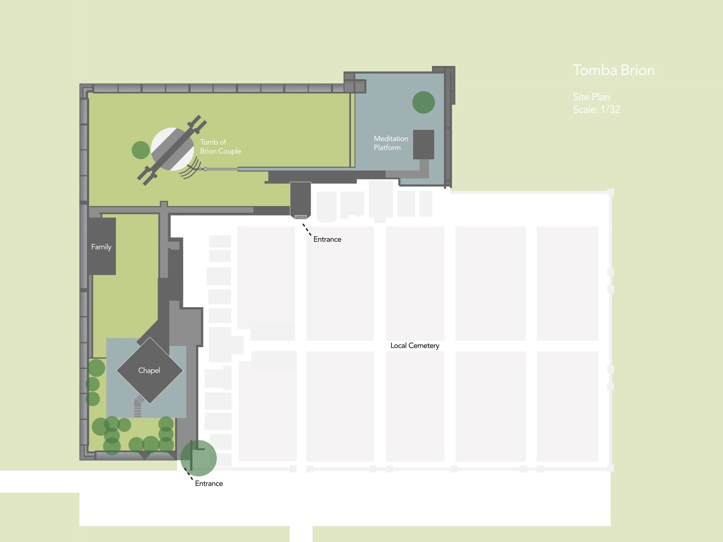
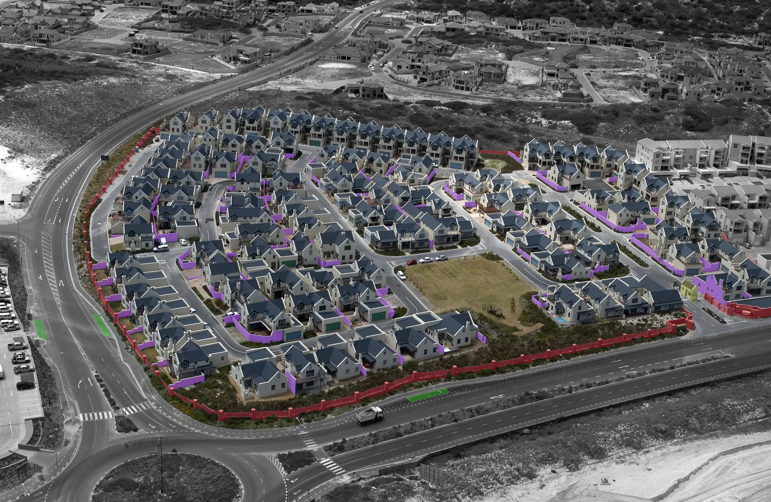
Gated communities with scales of divisional boundaries exacerbate fear through design that implies constant threat from others. The Kingshaven security estate in Cape Town, South Africa, becomes a residential node among the land and creates a hard boundary with a perimeter wall. Access is managed through a single vehicular entrance fitted with automatic gates and a guardhouse. No pedestrian access is given, and bus stops are placed without direct access. Inner blocks give way to the secure pod of the car, with no sidewalks and primary access to the garage. Small inner walls further separate the residents, giving more security and paranoia. Is there a better community design that balances the safety of the home without creating fear of others?
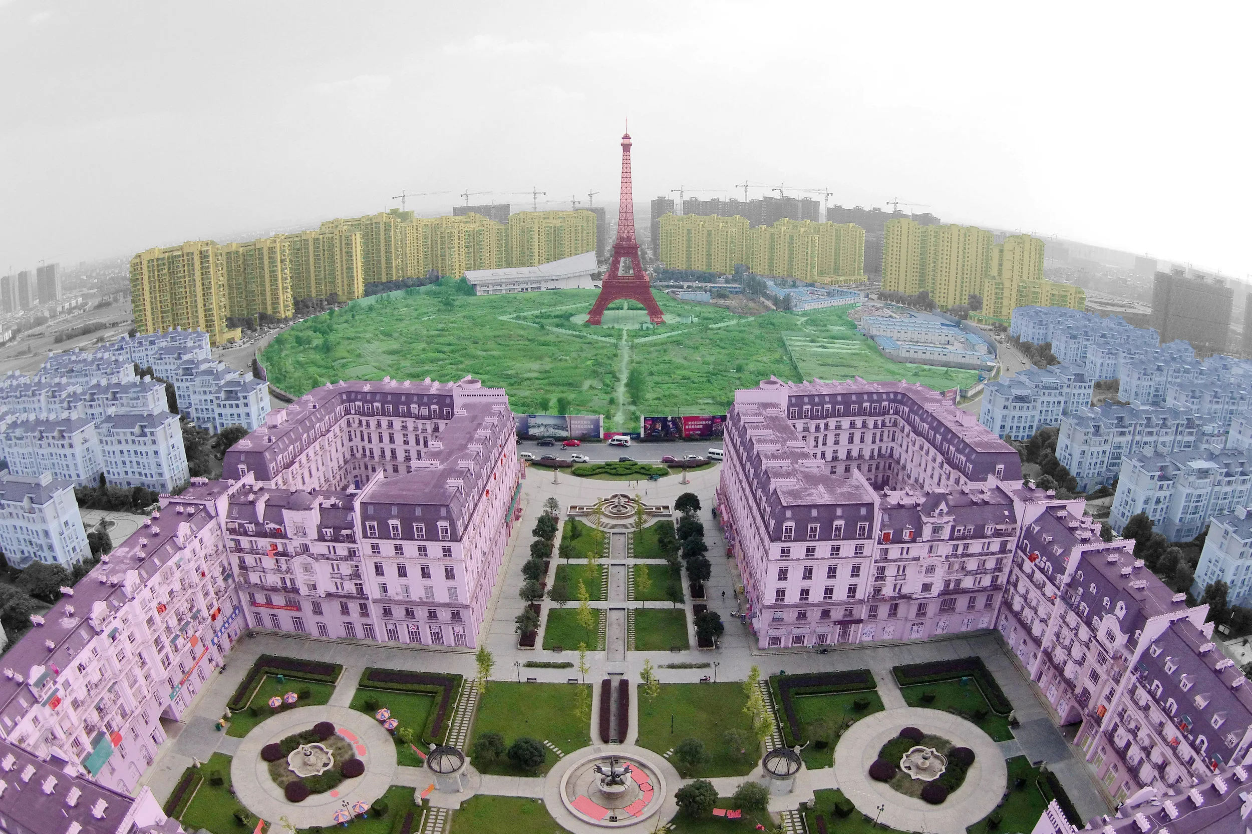
Transplanted cultural architecture for vanity fails to meet the deep-rooted cultural norms and daily function of the residents. Built around a replica of the Eiffel Tower, the development builds out a dominant axial arm. Built off a Parisian-inspired garden space, the residences take the form of the iconic sawtooth architecture with mansard roofs. Adjacent to the central core, buildings of growing height coexist, but slowly lose architectural detail. The central plaza, lacking the population the housing implies, transforms into agricultural land for the few. Signs of cultural differences and functional inefficiencies find residents, for example, hanging up clothing to dry throughout. How do new developments like this attract through dreams of upward mobility, while better serving the cultural needs of the area?
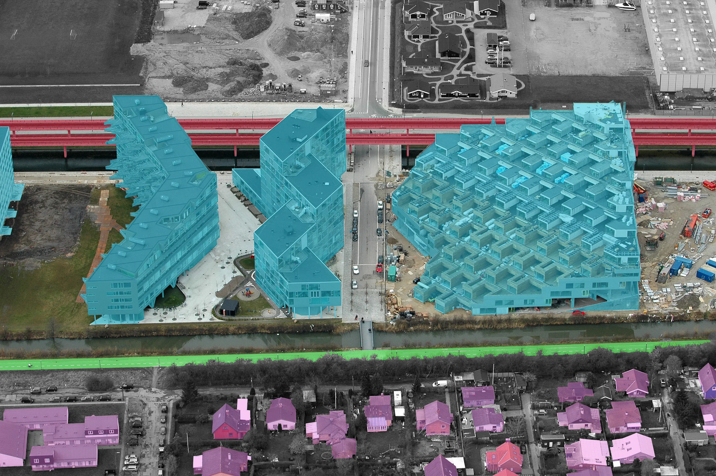
Residential communities designed with direct and equal access to transportation modes give greater flexibility and freedom to residents. In this segment of new development in Copenhagen, a central axis of transportation dominates land organization. The raised railway becomes the main means of focus and transportation. Parallel to the railway, and following the axis, is a bike path. Placed directly between the two throughways of transportation modes are dense housing developments. The tall buildings maximize occupancy while minimizing footprint, keeping wide pedestrian spaces free between. This stands in contrast to the traditional houses of the suburb that spread themselves across the landscape below. What effects does this development have on these surrounding neighborhoods? How does a large-scale development like this attract new residents? Are buildings designed by famous architects the key here? Has this design been successful for the city of Copenhagen and similarly in other cities?
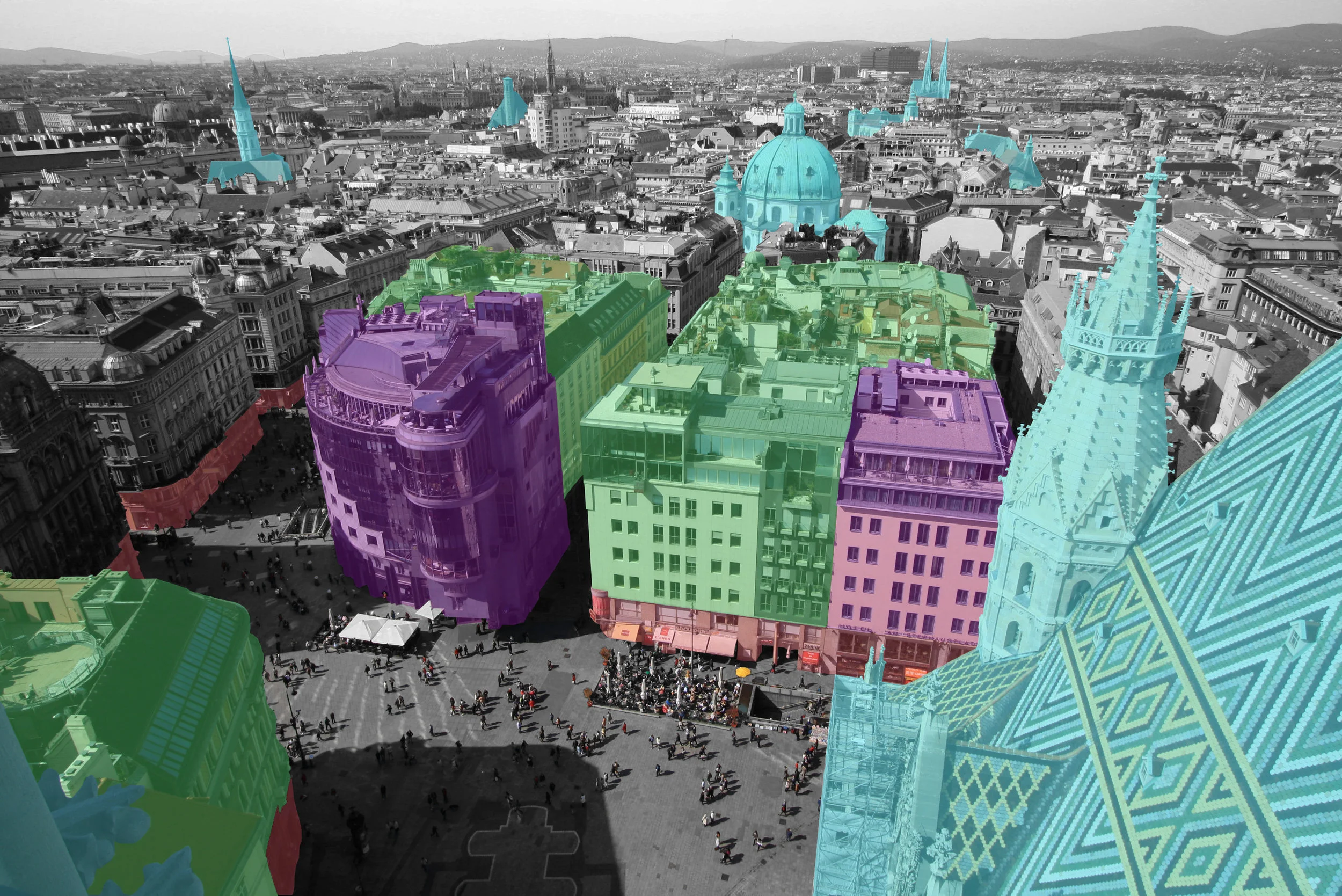
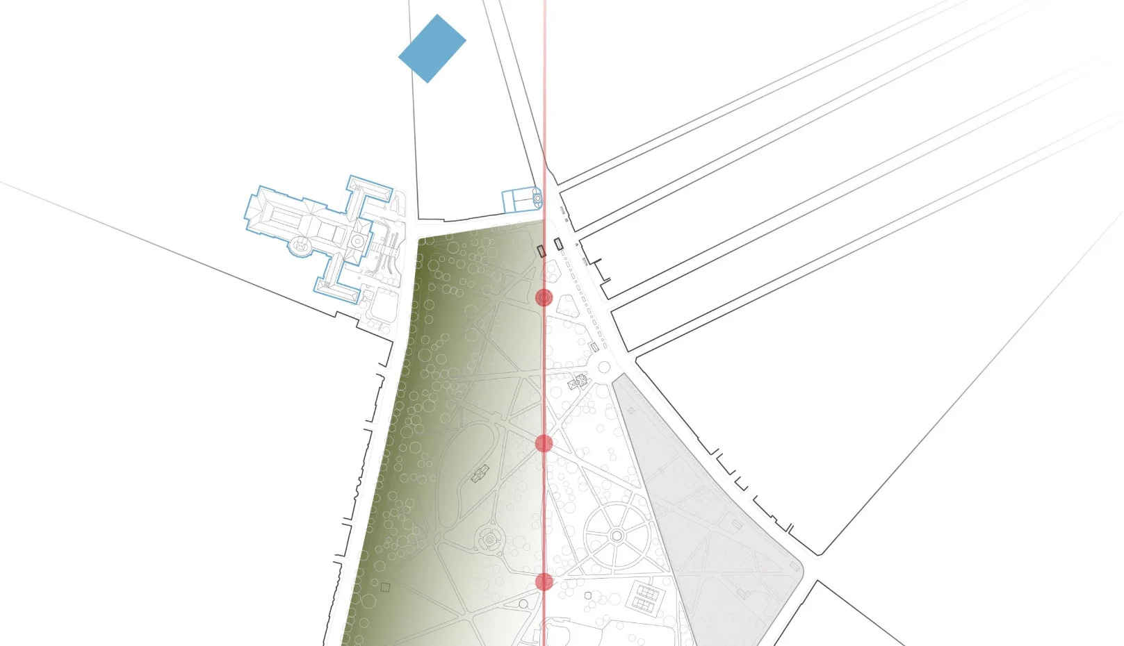
Cities designed with tight mixed-use adjacencies and dispersed public nodes offer the best lifestyle. Vienna, Austria, ranked the world’s most livable city, offers a distinct designed scale. Implied by the even placement of the churches, the city is designed around tight adjacencies for residents. Between the Home and the destination, the street level is the connection of access to goods and services. The street here, with no clear vehicle passage, gives priority to the pedestrian. Looking at the blocks that are in easy reach, it appears two hotels are placed, giving visitors direct access to the central area of the city. Around them, though, and above the street level, is housing. Placed mostly on the inner streets, it offers the residents privacy while still giving them the convenience of hopping down to the street to enter the action of the city. With a worldwide ranking for livability, how does the US code adjust for this kind of setup? And can existing cities transform to align with this model?
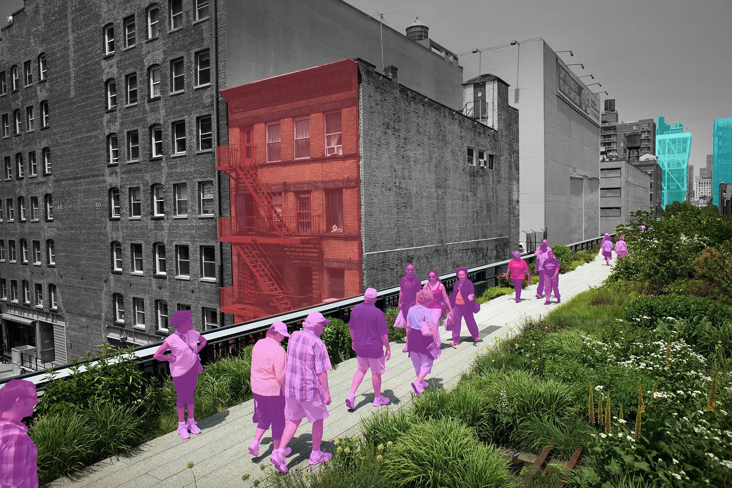
Design motivations for the benefit of many place powerful design into community ownership, leading to unplanned prosperity. New York City’s High Line Park transforms a structure slated for demolition into a scenic greenway for the residents. The park funnels people through the city blocks, removes them from the chaos of the streets, and puts the plants and buildings on full display. Designed to enrich the lives of the locals, word spreads, and its popularity grows. High Line adjacency brings an audience, and the spotlight is cast. Buildings, Art, and people are center stage. A workshop window becomes a screen, or a fire escape becomes a stage. As a community-supported, designed, and funded project, the High Line becomes owned by the people of the neighborhood and displays a sense of belonging through the display of locals. Originally slated for demolition by developer interest, the High Line found allies in the community who saw the potential in its function to benefit the people of the neighborhood, not the bank account of the developers. By proving to be a powerhouse of popularity, new development ironically finds new prosperity by locating housing in close proximity. With this accelerated development in the area, how will the High Line evolve? Will its community sense remain? Will collectivized interest guarantee its preservation and function?
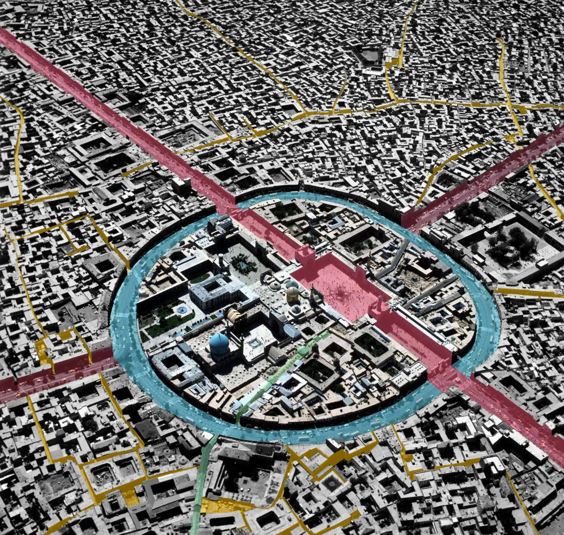
The central religious form becomes the heart of the city, pumping life in and out, evolving to keep the flow. Visual scale and a center stage position set an ultimate relational importance to the shrine. Dense areas of buildings crowd in, vying to be in close proximity. The heart grows through time with the flow of the people as religion is central. Between the core and wedges, a circulation ring becomes the threshold into the sacred. A major axis bursts in and invites in the community. Two additional arteries form the cross axis. Among the core, covered circulation spaces emerge, becoming part of the fabric. Past the ring, circulation funnels the people from the public core into the wedges, where smaller streets and alleys isolate families and individuals into their private courthouses.
Today the central heart has burst from its perimeter, taking living space away from the people and instead strengthening what is number one. When a central belief system determines daily function, does major physical evolution become unanimously understood and accepted? Do people willingly relocate to accommodate the needs of the community? This may be a self-designed effect created by a city layout which places the religious entity in the center of people’s daily universe and thus creates a self-fulfilling organism that grows.
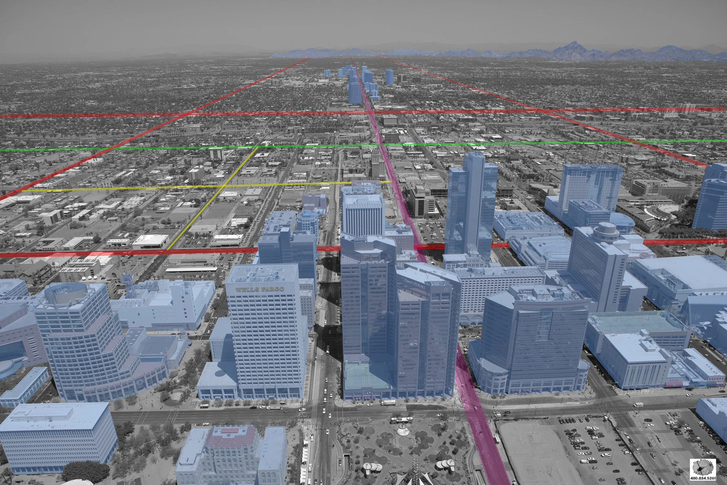
A dominant grid system places logic and controlled regularity on the unmarked land of the Arizona desert. A flat, barren landscape with scattered mountainous geography finds order through a nationally established baseline grid. The baseline becomes Baseline Rd, and an efficient system of parallel roads, each set a mile apart, defines an East-West order. The Central Avenue running North-South sets the base coordinate for focused development and sets forth a system of parallel blocks divided by streets named numerically higher the farther away they develop. Sub-streets slowly develop, conforming to the grid, giving further detail and scale to the system. Having developed off a nationally designed grid with perhaps little consideration to change in climate across the continent, the question arises as to how the city grid performs in this desert environment? Maybe it implies that the power of the logically developed machine counters any negative effects the climate has on the simplicity of life in the grid.
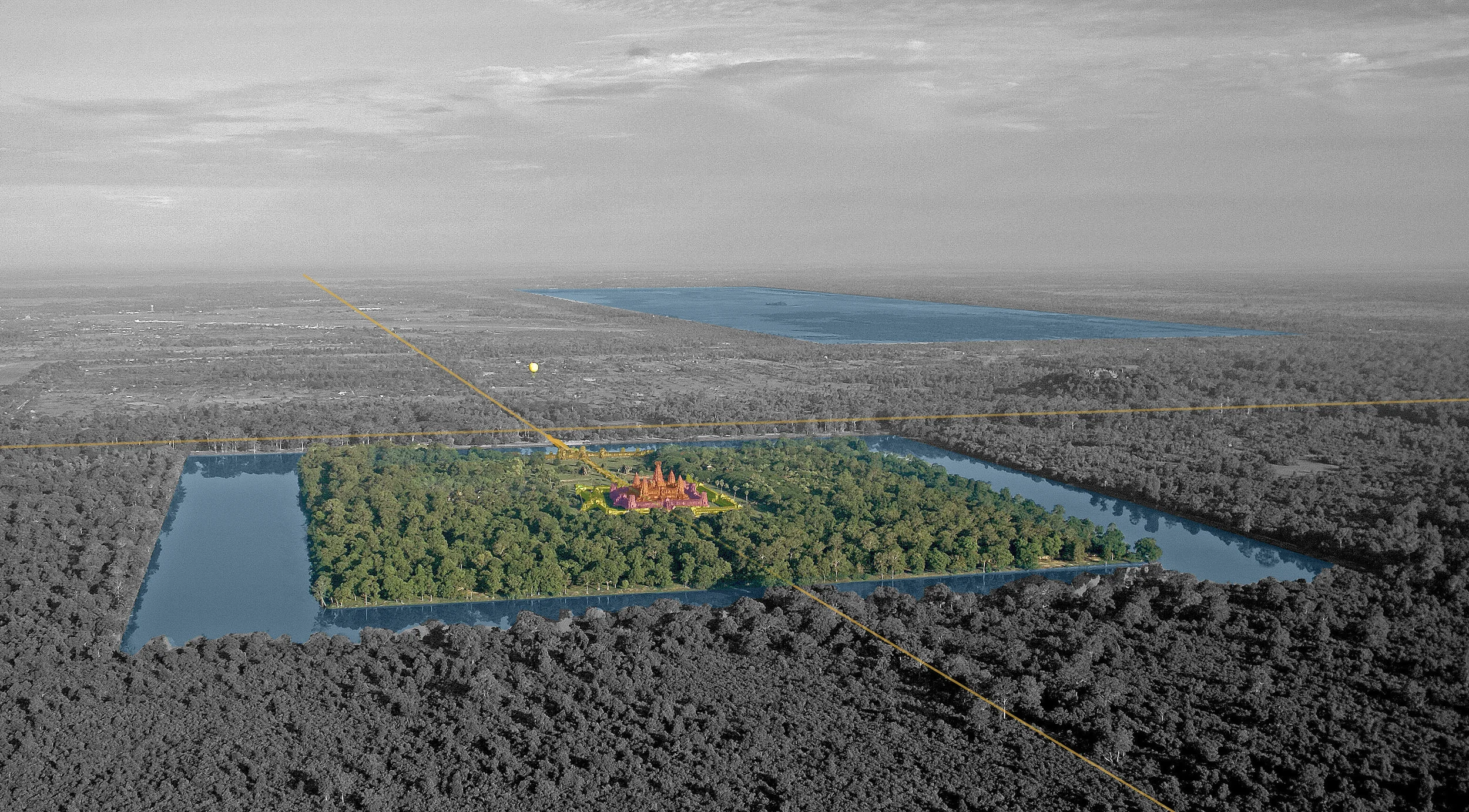
Angkor Wat composes a monumental reality of scales bridging the world of the human to the cosmos. Built on Asian traditions, it borrows from Hindu and Buddhist beliefs and is in honor of the god Vishnu. As the preserver of the Universe, the temple bridges the preservation of the cosmos with the preservation of the people. The large Baray system sustains life and is the spiritual representation of the seas surrounding Mount Meru, font of the Hindu cosmos. The massive scale challenges how axial and spatial composition could be grasped by a human, but through changes in plan and form, the scale becomes vast. Does human perception then jump to the scale of the cosmos? What would living be like in a place of such magnitude?